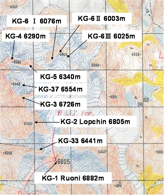
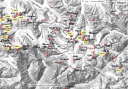
1. KG-Study_Maps_sorted_Six-thousanders ---------------------------- NOV 10 2010 NOV 10 2010
2. KG-whole_Map-6000mpeaks---------------------------------------JAN 08 2011
2. KangriGarpoSketchMap-v4.0---------------------------------------MAR 22 2011
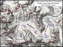 |
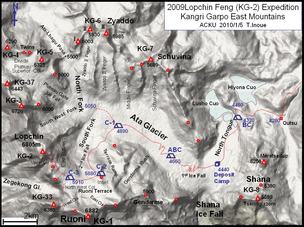
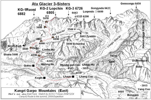
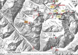
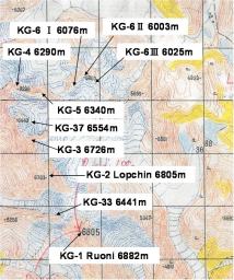
Climbing route map in the Ata Glacier to Lopchin Feng 6805m
ACKU Expedition 2009 |
|
|
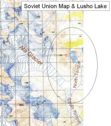 |
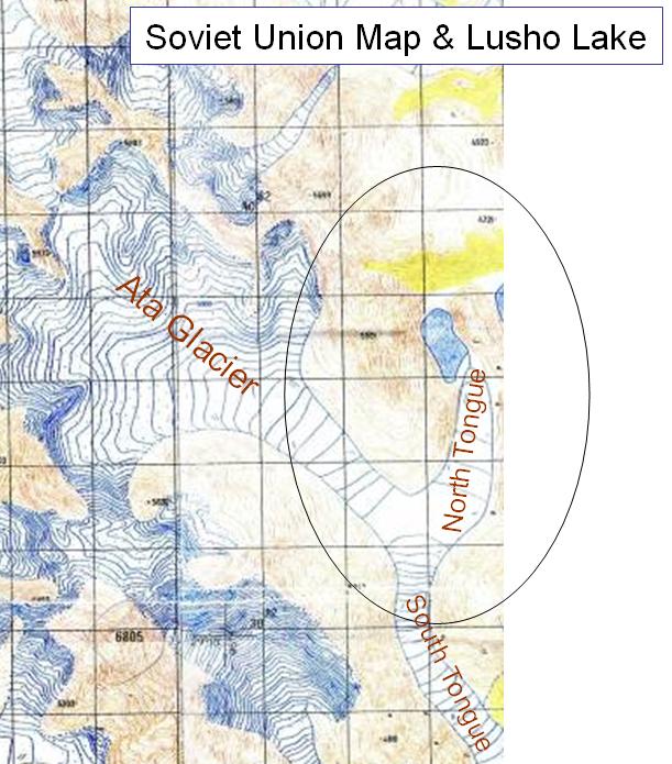
Old Map
Soviet Union
Single Lusho Lake infront of the snout of Ata Glacier
|
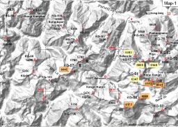 |
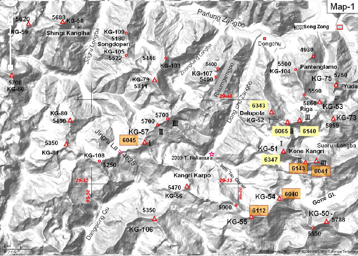
Area-1 Delupola and Kone Kangri (1) |
 |
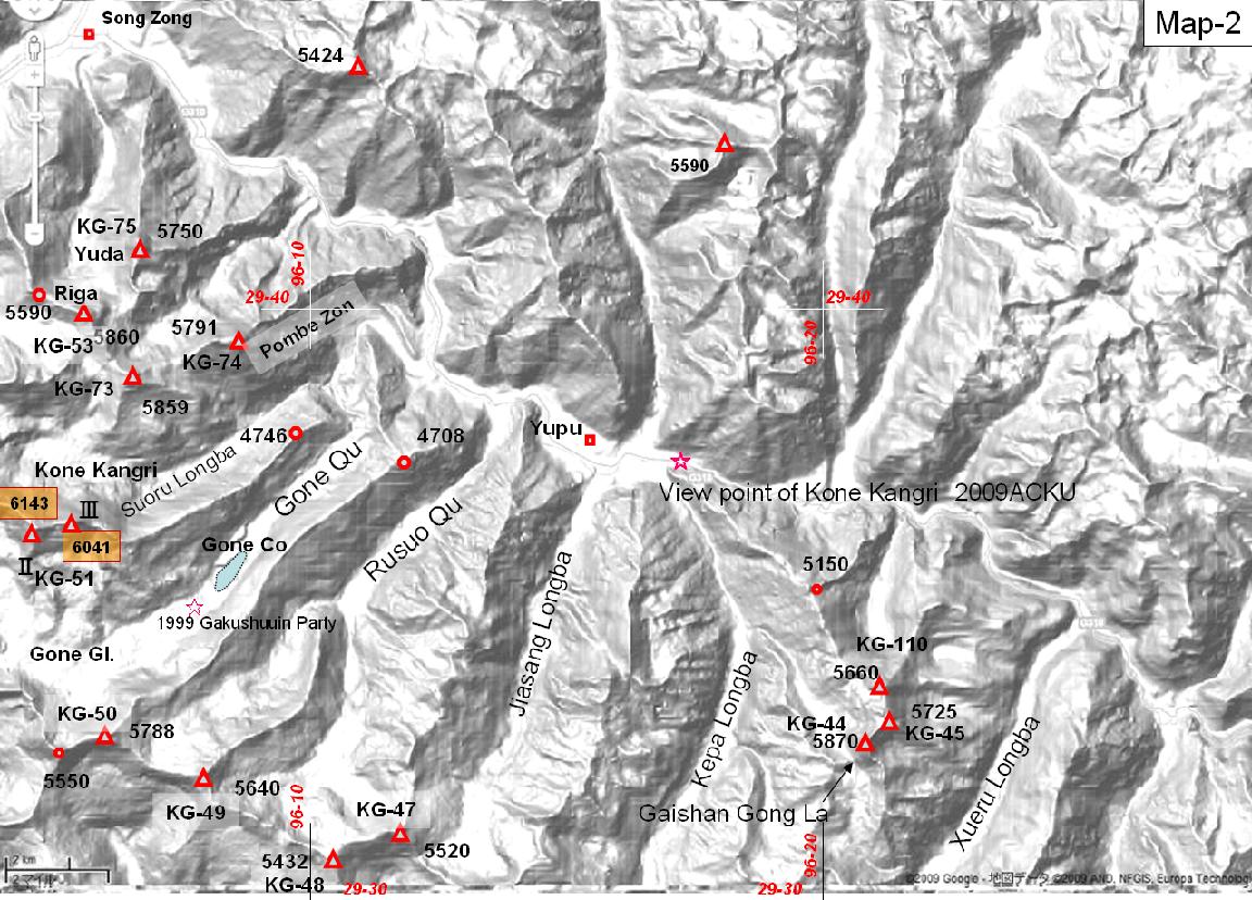
Area-2 Delupola and Kone Kangri (2) |
 |
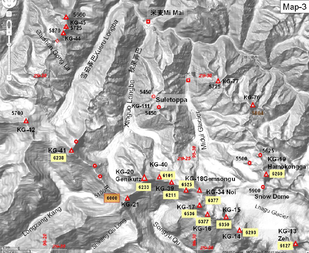
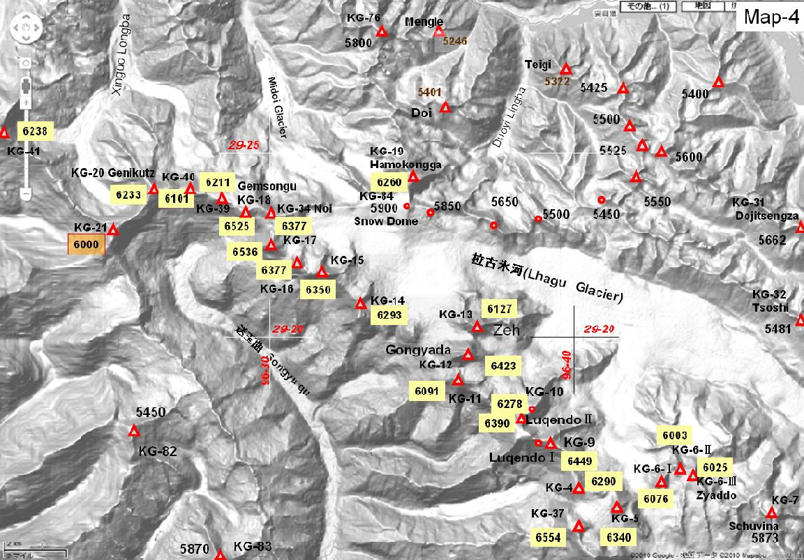
Area-3 Genikutz and Gemusongu |
 |
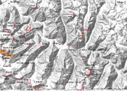
Area-4 Lhagu Glacier |
 |
Area-5 Ata Glacier and the south |
 |
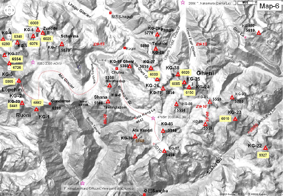
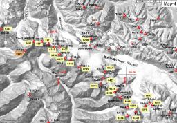
Area-6 Ata Glacier and Gheni Glacier |
 |
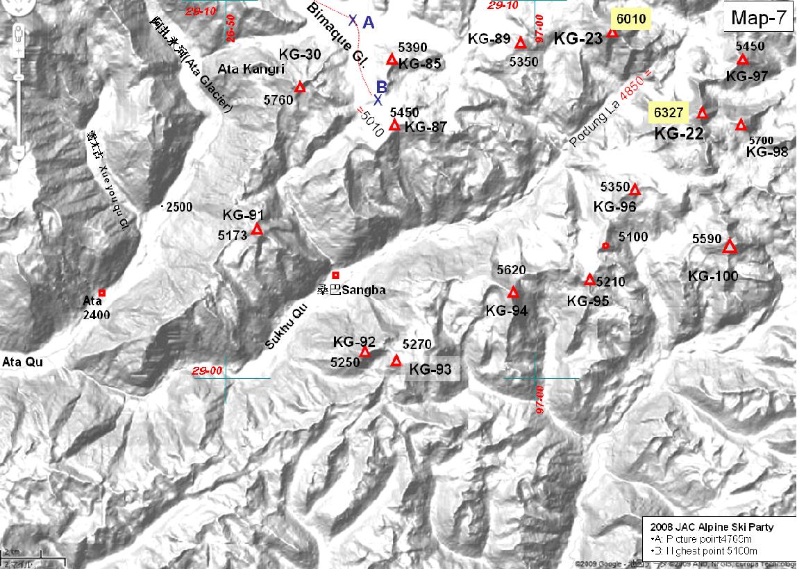
Area-7 KG-22 Far east end of Kangri Garpo |
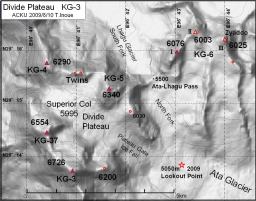 |
Divide Plateau & KG-3 (A)
configuration of Peaks and Ridges on the main divide of kangri Garpo East |
 |
Divide Plateau & KG-3 (B)
Lack of some peaks in the Soviet Union Map
Compare with above map. |
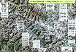 |
47 six-thousanders |
(c) Copyright: The Alpine Club of Kobe University 2011
|